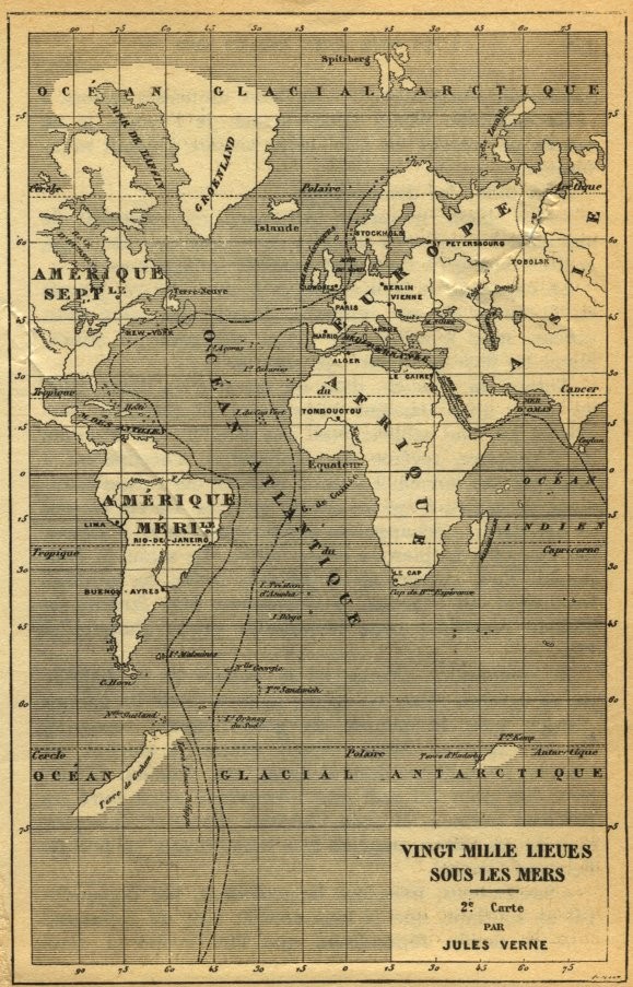
Jules Verne's Nautilus Route Map — Vingt Mille Lieues Sous Les Mers
Submarine navigation charted as science fact: this is the second official route map from Jules Verne's Twenty Thousand Leagues Under the Sea, tracing the Nautilus's extraordinary underwater voyage across the world's oceans. Engraved in precise cartographic style, the map plots Captain Nemo's path through the Atlantic, Indian Ocean, and polar seas, transforming speculative underwater travel into a navigational document of breathtaking ambition. Latitude and longitude grids frame continents labeled in French, with dotted voyage lines cutting through uncharted deep-sea territories.
It's just a map, but knowing it traces where the Nautilus actually went gives me chills — those dotted lines go places no ship has ever sailed! Captain Nemo really did go everywhere.
“VINGT MILLE LIEUES SOUS LES MERS 2e Carte PAR JULES VERNE OCEAN GLACIAL ARCTIQUE OCEAN GLACIAL ANTARCTIQUE AMERIQUE SEPT. AMERIQUE MERI. OCEAN ATLANTIQUE OCEAN INDIEN Spitzberg Islande Groenland Terre-Neuve New-York Buenos-Ayres Rio-de-Janeiro Lima C. Horn Terre de Feu Stockholm Petersbourg Berlin Vienne Paris Madrid Alger Tombouctou Le Caire Le Cap Equateur Tropique Polaire Cancer Capricorne Antarctique Terre d'Hobart Ile King Ile Macquarie”

