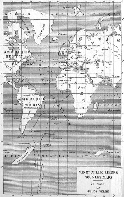
Jules Verne's 20,000 Leagues Under the Sea — Nautilus Route Map, 1870
A world unfolds in stark engraved lines — this is the second navigational chart from Jules Verne's landmark undersea adventure, tracing the Nautilus submarine's extraordinary global voyage across the Atlantic, Indian, and Antarctic oceans. Rendered in precise 19th-century cartographic style, the map plots curved route lines threading from New York southward through the South Atlantic and beyond, grounding the fantastical journey in scientific credibility. It is a map of imagination disguised as geography.
No tentacles, no ray-guns — just the cold, elegant promise of a madman's submarine plotting a course to the bottom of the world. The adventure is all in the lines.
“VINGT MILLE LIEUES SOUS LES MERS 2e Carte PAR JULES VERNE OCEAN GLACIAL ARCTIQUE OCEAN GLACIAL ANTARCTIQUE AMERIQUE SEPTLE AMERIQUE MERID ATLANTIQUE OCEAN INDIEN Spitsberg Grœnland Islande Stockholm Petersbourg Tobolsk Berlin Vienne Paris Londres Alger Le Caire Tombouctou New-York Lima Rio-de-Janeiro Buenos-Ayres Le Cap Polaire Antarctique Cancer Capricorne Equateur Tropique de Capricorne”

